
The short version
In Kruger, the roads that follow permanent water tend to be the ones that deliver. Rivers, dams and waterholes pull animals in, especially in the dry winter months, and most of the famous roads are river roads.
Nothing here is a guarantee. Kruger is nearly two million hectares of wild country, and a quiet morning on the “best” road happens to everyone. But if you only have a few days, these are the roads worth planning around.
A note on rankings: where we say a road is popular or highly rated, we name who says so. Two useful references are a 2022 reader poll by HPH Publishing, which produces Kruger guidebooks, and Getaway magazine’s self-drive guide.
Before you drive: closures
Kruger had severe flooding in February 2023 and again in January 2026, and repairs are still going on. In 2026 SANParks closed a long list of gravel roads, including some in this guide. Heavy rain also closes gravel roads at short notice: on 11 August 2026, seven roads around Lower Sabie were closed in a single update.
SANParks has warned that driving a road marked “No Entry” is an offence. Check the latest SANParks road updates before you set out, and ask at camp reception.
South: Skukuza, Lower Sabie and Crocodile Bridge
H4-1: Skukuza to Lower Sabie
The best-known road in the park. The H4-1 runs about 43 km along the Sabie River, mostly tar with gravel loops off it. It came first in the HPH reader poll, and Getaway calls it one of the most popular roads in the park.
The river is the reason. It flows all year, so animals come to drink whatever the season. Stop at Nkuhlu Picnic Spot, about 20 km from Lower Sabie, and keep an eye on the riverbank as you drive.
The road was damaged in the 2023 floods. SANParks finished rebuilding the damaged culverts on 31 July 2026, and the road is open again.

The downside is traffic. A good sighting on the H4-1 can draw a long line of cars.
Sunset Dam
Barely a road at all: Sunset Dam is about 1 km from Lower Sabie camp. It’s the easiest early-morning or last-hour stop in the south, with hippos, crocodiles and a steady flow of animals coming to drink.

H10: Lower Sabie to Tshokwane
The H10 crosses the Sabie River at its southern end and heads north towards Tshokwane, 43 km from Lower Sabie. Mlondozi Dam picnic site, 17 km from camp, looks out over the water. HPH readers placed the H10 seventh and described it as one of the finest game-viewing roads in the park.
S28: the Nhlowa road, Crocodile Bridge to Lower Sabie
A 24 km gravel road that Getaway describes as very straight, flat and seemingly boring. Don’t let that put you off. The open country makes animals easier to see, and the road passes Nthandanyathi Bird Hide and Nhlanganzwane Dam. SANParks describes the wider Crocodile Bridge area as known for its lion prides.
The S28 was among the roads closed after rain in August 2026, so check it before you go.

S25 and S114
- S25 runs about 55 km along the north bank of the Crocodile River. HPH readers ranked it third.
- S114 runs south to north through several different habitats and carries little traffic. It came second in the HPH poll, which makes it the quiet alternative to the H4-1.
Central: Satara
SANParks describes the Satara area as an excellent game-viewing region with relatively open bush, where lion, leopard and cheetah are recorded regularly. The open grassland makes animals easier to spot than in the thicker bush further south.
S100: along the N’wanetsi River
Getaway calls the S100 probably the most popular road in the central region, with regular reports of lion, leopard, elephant and buffalo. It follows the N’wanetsi River east of Satara, and HPH readers ranked it fifth.

Getaway suggests a 60 km loop from Satara combining the S90, S41 and S100, passing Gudzani Dam. The S41 was on SANParks’ 2026 closure list, so confirm it’s open before planning the loop.
H7: Orpen to Satara
45 km of tar across flat grassland, passing Nsemani Dam. HPH readers ranked it ninth and called it one of the better roads for lion, leopard and cheetah.
After the January 2026 floods, SANParks reduced the H7 to one lane at Nsemani Dam and banned vehicles over 8 tonnes. If you’re entering at Orpen, also check access outside the park: a bridge on the approach road washed away in April 2026.
Sweni Bird Hide
On the Sweni River, about 30 km from Satara. A good place to sit quietly for an hour in the heat of the day.
Olifants and Letaba
Olifants River
Olifants camp sits on a hill high above the river, with lookout platforms, and the views alone make it worth the drive. Getaway recommends the short 12 km S91/S92 loop, with the N’wamanzi Lookout and a crossing on the high-level bridge. SANParks notes that Cape clawless otters have been seen from the Olifants lookout on the gravel road towards Letaba.

Letaba
SANParks describes the sandy Letaba riverbed as an excellent game-viewing spot, with plenty of elephants. Getaway lists three short river roads:
- S95, about 4 km along the Letaba River
- S47, about 13.5 km along the river (on the 2026 closure list, so check first)
- S62, about 10 km, passing the Mingerhout Dam lookout, Matambeni Bird Hide and Longwe lookout
The Letaba High-Level Bridge reopened in March 2026 after flood damage, but Letaba camp is still only partly open.

North: Punda Maria and Pafuri
The far north is quieter, with fewer big cats but species you won’t see further south.
- S99, the Mahonie Loop, at Punda Maria. SANParks calls it the best place in Kruger to see the tiny suni antelope, and HPH readers ranked it tenth for plants and animals that are scarce elsewhere in the park. It was on the 2026 closure list, so check before you go.
- S56, along the Mphongolo River. It follows a seasonal river and ends at Babalala Picnic Site. HPH readers ranked it sixth.
- Pafuri. The picnic site sits on the Luvuvhu River, where SANParks says you’ll see plenty of nyala. It’s a long drive from anywhere, so make a day of it.
Rules that matter on the road
- Speed limits: 50 km/h on tar, 40 km/h on gravel. Speeding is fined.
- Stay in your vehicle except at designated places such as picnic sites, hides and camps. Don’t hang arms or heads out of the window.
- Be back before the gates close. You can’t drive after dark, and late arrivals can be fined.
- “No Entry” means no entry, including roads closed for flood damage.
SANParks gate times vary by month and can change without notice:
| Months | Gates open | Gates close |
|---|---|---|
| Jan–Feb | 05:30 | 18:30 |
| Mar | 05:30 | 18:00 |
| Apr | 06:00 | 18:00 |
| May–Jul | 06:00 | 17:30 |
| Aug–Sep | 06:00 | 18:00 |
| Oct | 05:30 | 18:00 |
| Nov–Dec | 05:30 | 18:30 |
When to go
SANParks describes April to September as the dry winter months, when dry weather draws animals to waterholes and game viewing is at its best. The bush thins out and animals stay close to the rivers, which is exactly why these roads work.
Summer, roughly October to March, is green and beautiful, but the bush is thick, animals spread out, and rain closes gravel roads more often.
Explore more on 25South
- Kruger National Park: A First-Timer’s Safari Guide: gates, camps and planning.
- Kruger National Park map: the camps and gates.
- Kruger Where to Stay: the SANParks rest camps.
- Self-Drive vs. Guided Safari: which suits you.
Sources
- SANParks, vital information
- SANParks, entrance gates
- SANParks, Lower Sabie
- SANParks, Crocodile Bridge
- SANParks, Satara
- SANParks, Olifants
- SANParks, Letaba
- SANParks, Punda Maria
- SANParks, climate
- SANParks, road damage update, February 2026
- HPH Publishing, Your favourite routes in the Kruger, 2022
- Getaway, Kruger National Park’s 10 best self-drives
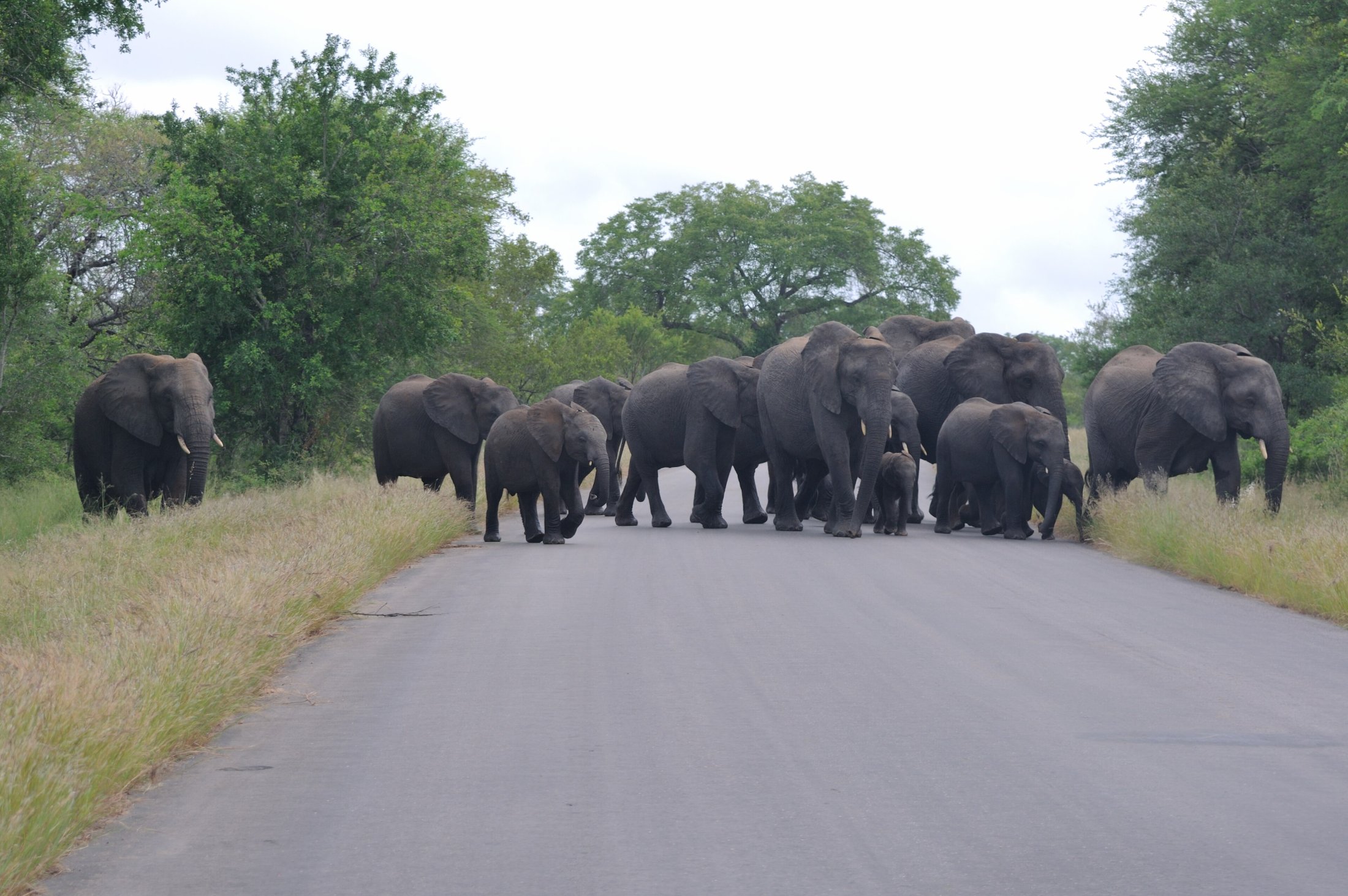
Top photo: Hansueli Krapf / CC BY-SA 3.0, via Wikimedia Commons