
Region: Africa (Southern & East Africa) · Type: Review
If you’ve ever planned a self-drive trip through Namibia, Botswana or the wilder corners of East Africa, you’ve probably already come across the name Tracks4Africa — often shortened to “T4A” in overlanding circles. It shows up in rental-car briefings, on forums, in the glovebox of nearly every seasoned self-driver’s vehicle. But T4A isn’t a big tech company that spotted a gap in the market. It’s a homegrown South African project that started as a favour between friends and grew into the standard navigation tool for an entire continent of remote travel.
A quick note before we get into it: this isn’t a sponsored feature. Tracks4Africa hasn’t paid for or requested this article — we’re writing about it simply because it’s a tool we use ourselves and think our readers should know about.
From a Hobby to a Company
Around the year 2000, GPS units became affordable enough for ordinary travellers to carry — but the maps loaded onto them were close to useless outside Africa’s cities and national highways. Manufacturers had mapped the roads that mattered to them; the sand tracks of Kaokoland, the pans of the Kalahari and the back roads of the Zambezi region simply weren’t on anyone’s radar.
A small circle of Namibia-obsessed travellers, including engineer and data analyst Wouter Brand and civil engineer Johann Groenewald, started doing it themselves: recording GPS tracks and waypoints on their own trips and swapping the files with each other so the next person wouldn’t get lost in the same stretch of desert. In 2001 the community got a name — Tracks4Africa, suggested by fellow traveller Johan Strumpfer — and a website where people could upload and download data.
What began as a hobby became a company in 2003, formed to look after the growing pool of community data and turn it into an actual map. By 2005, Tracks4Africa was selling GPS maps commercially for the first time. Then, in 2007, it became the first company anywhere to offer a routable GPS map covering the full Cape-to-Cairo route — a genuine milestone for African overland travel, achieved entirely on data contributed by ordinary travellers rather than a commercial survey.
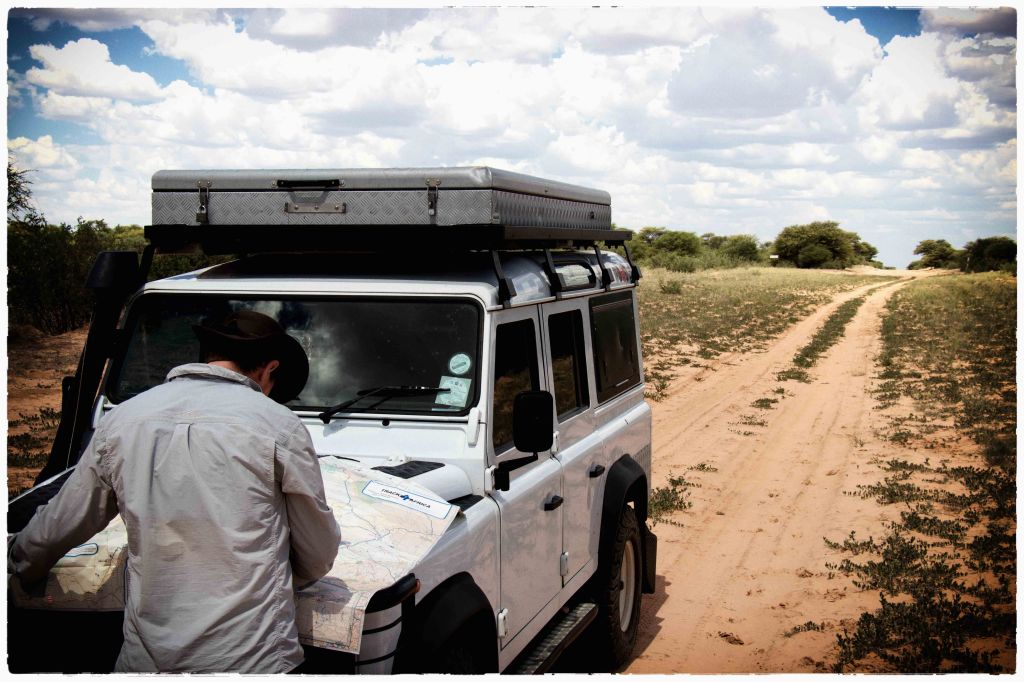
The Man Behind the Map
Wouter Brand, T4A’s co-founder, died in June 2024 at the age of 69, and the tributes that followed said a lot about what the company actually is. Johann Groenewald, who now owns and runs Tracks4Africa from its head office in Paarl, South Africa, described Brand as “a legend in his own time” whose “relentless pursuit of excellence” laid the foundation for everything the company later built. Expedition Portal, the well-known American overlanding publication, credited T4A as a genuine forerunner to the crowd-sourced navigation apps travellers now take for granted worldwide, including iOverlander and maps.me.
It’s a reminder that behind the app icon is a two-decade project built by travellers, for travellers — not a corporate mapping product retrofitted for Africa.

What Tracks4Africa Offers Today
The company, now around twenty people strong, has grown a small family of products, all built on the same crowd-sourced core: a fully vector-based map covering the whole of Africa, a road network currently touching some 1.5 million kilometres — focused on the routes overlanders actually travel — and a database of roughly 291,000 points of interest and more than 50,000 traveller photos, updated quarterly.
The Tracks4Africa app (iOS and Android) is the version most independent travellers reach for first. It’s an offline app — no signal required — showing a detailed map layered with campsites, fuel stations, border posts, water points and other essentials, each with traveller-contributed notes and sometimes photos. The app is in the middle of a generational change: the long-standing Guide App is being replaced by a completely rebuilt app, simply called the Tracks4Africa app, sold as a one-year subscription that covers all regions and includes the Trip Planner as a single product. (Existing Guide App users who bought a region in-app are being granted a lifetime base subscription — a classy touch.) The new technology stack is the foundation for what’s coming next: offline route calculation is in active development, with Android Auto and Apple CarPlay support planned once routing is in place.
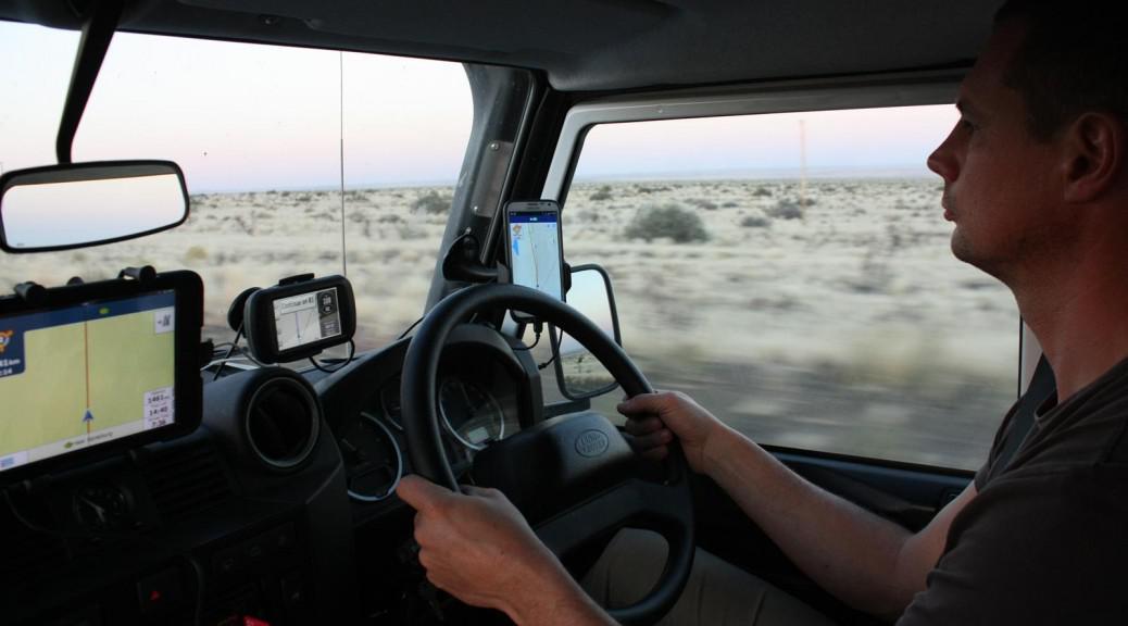
T4A GPS Maps are the original product, built for Garmin devices via downloadable map files or a preloaded SD card, sold on a subscription that includes quarterly updates.
Paper maps, wall maps and country guidebooks are still very much part of the range — a deliberate nod to travellers who want a physical backup when the batteries die or the electronics fail in the middle of nowhere. If anything, the physical range is being actively expanded, because demand for it keeps growing.

The T4A Trip Planner (a web-based tool) rounds out the offering, letting travellers plan routes and explore the map before they ever leave home. Routes and trips planned on the platform can be synced to the app for offline use on the road.
It’s worth being clear about what Tracks4Africa is not — at least for now: it isn’t a turn-by-turn navigation app like Google Maps or Waze. It’s a reference and planning tool, built around the question “what’s actually out here?” rather than “turn left in 200 metres.” That said, this is exactly what the rebuilt app is designed to change — offline routing is already at proof-of-concept stage, so expect that line to need rewriting before long.
Why Overlanders Swear By It
Ask anyone who has actually self-driven through Namibia’s Kaokoland or Botswana’s Kalahari what got them there and back safely, and Tracks4Africa comes up constantly. Across overlanding forums and travel blogs, a few things get mentioned again and again: the sheer depth of the points-of-interest database, which regularly includes dirt tracks, waterholes and community campsites that don’t exist on any other map; traveller-sourced time estimates for a given stretch of road, which tend to be far more realistic than a generic routing algorithm’s guess; and full offline functionality, which matters enormously in regions where mobile signal disappears for hundreds of kilometres at a time.
Reviewers on forums like Expedition Portal and 4x4community.co.za consistently describe it as the standard companion for East and Southern African overlanding — often replacing a printed guidebook altogether, and doubling as a way for travellers to find each other on the road.
We can vouch for this ourselves. On our own 4,000 km self-drive through Namibia and Botswana in May 2026, Tracks4Africa was a constant, dependable companion — from planning the route long before we left home, to finding fuel stops, water crossings and campsites we’d never have located otherwise. It simply didn’t let us down.

Getting Started
The Tracks4Africa app is the simplest entry point for most independent travellers — download it, take out the one-year subscription (which covers all regions and includes the Trip Planner), and it works offline from day one. Serious overlanders running a dedicated GPS unit will likely want the Garmin-compatible T4A GPS Maps instead, with paper maps as a sensible backup for anyone heading into genuinely remote territory. Everything is available directly through Tracks4Africa’s own shop.
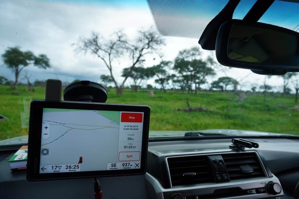
If you’ve read our guide to 4×4 hire and self-drive in Namibia, you’ll already have seen Tracks4Africa mentioned as the standard offline tool for the region — this is the story of how it got there.
 25South