There are not many places on earth where you can switch off your engine, sit in silence, and let Africa come to you. Etosha is one of them. Built around a vast, shimmering salt pan in northern Namibia, this is a park made for self-drivers: hundreds of kilometres of well-graded gravel, waterholes you can park beside for hours, and wildlife that gathers in extraordinary numbers around the only water for miles. After our own weeks on Namibia’s roads — see our 4×4 hire & self-drive guide — Etosha was the place we kept coming back to in conversation.
This is the long version: every gate, every rest camp (inside the park and the private reserves around it), the road network sector by sector, a full breakdown of the waterholes — which one for which animal, and when — an honest look at the seasons month by month, and sample itineraries you can actually drive. If you only read one Etosha guide before you go, make it this one.
🧭 AT A GLANCE — Etosha in one box
- Where: northern Namibia, ~430 km (5 hrs) from Windhoek via Anderson Gate.
- Size: ~22,270 km², built around a 4,800 km² salt pan visible from space.
- Why it’s special: the continent’s premier waterhole safari — you wait at water rather than chase animals; outstanding for black rhino, elephant and big cats.
- Self-drive? Yes — one of Africa’s easiest self-drive parks. Good gravel; a 2WD copes most of the year, but a higher-clearance vehicle is more comfortable.
- Gates: Anderson (south), Von Lindequist (east), King Nehale (north), Galton (west — Dolomite guests only).
- In-park camps: Okaukuejo, Halali, Namutoni, Dolomite, Onkoshi, Olifantsrus (NWR-run).
- Best months: August–October for peak waterhole action; December–April for green-season birding, newborns and flamingos.
- The two iron rules: be inside camp by sunset; stay in your vehicle except at marked points.
📍 In this guide
- Why Etosha is the perfect self-drive park
- The big idea: Etosha is a waiting game
- Getting there and the four gates
- Park fees and the rules that matter
- Every rest camp inside the park
- The private reserves around the park
- The waterholes — the heart of Etosha
- The routes and circuits
- How to actually drive Etosha
- When to go — the seasons in depth
- Suggested self-drive itineraries
- Practical checklist
Why Etosha is the perfect self-drive park
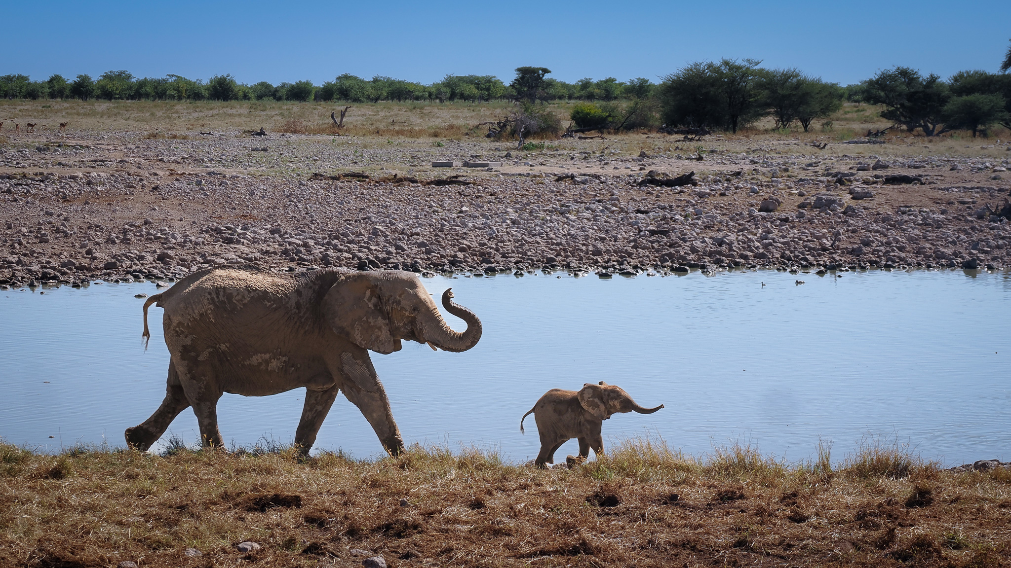
Etosha translates loosely as “the great white place,” a nod to the 4,800 km² salt pan at its heart — so large it is visible from space. The pan itself is mostly lifeless, a blinding white expanse of cracked clay that floods only briefly in a good rainy season. But its edges are ringed with waterholes, and in the dry months those waterholes become the busiest stages in Namibia.
What makes Etosha ideal for independent travellers is the infrastructure. The road network is good graded gravel, navigable in an ordinary 2WD car for most of the year, and the waterholes are marked, signposted and easy to find. You do not need a guide, a tracker or a 4×4 to have a world-class day here. You need patience, a full tank, and a flask of coffee.
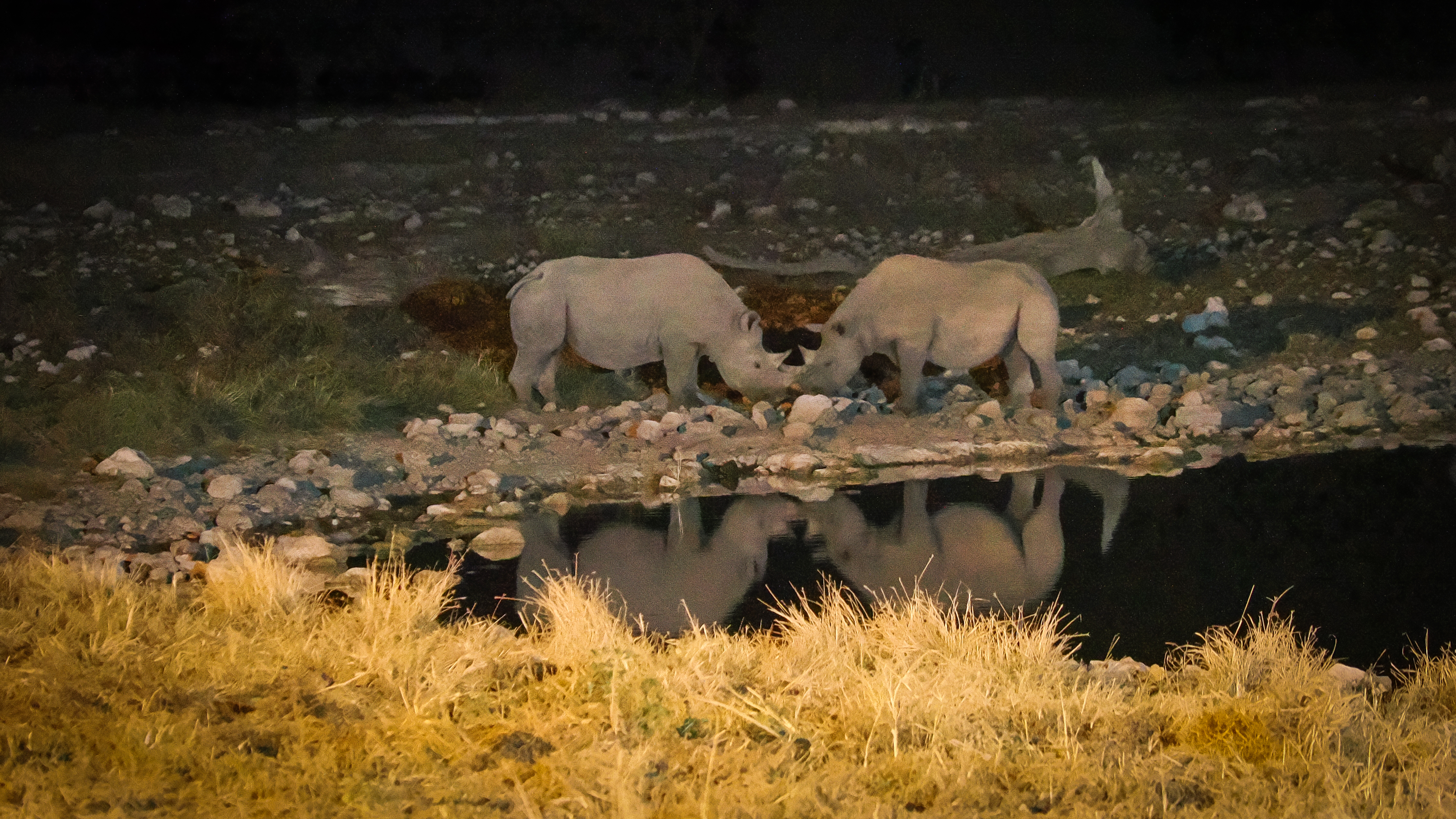
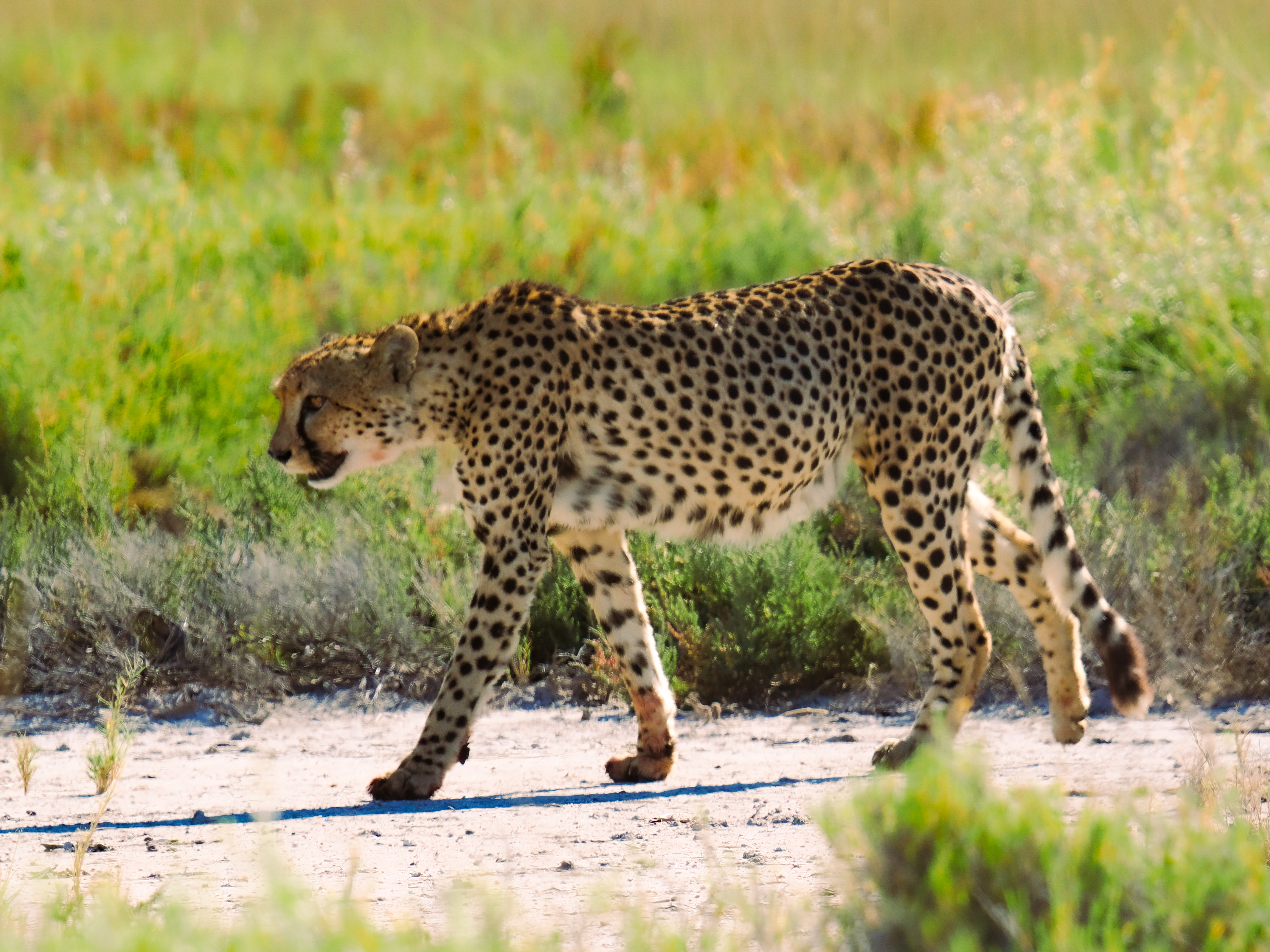
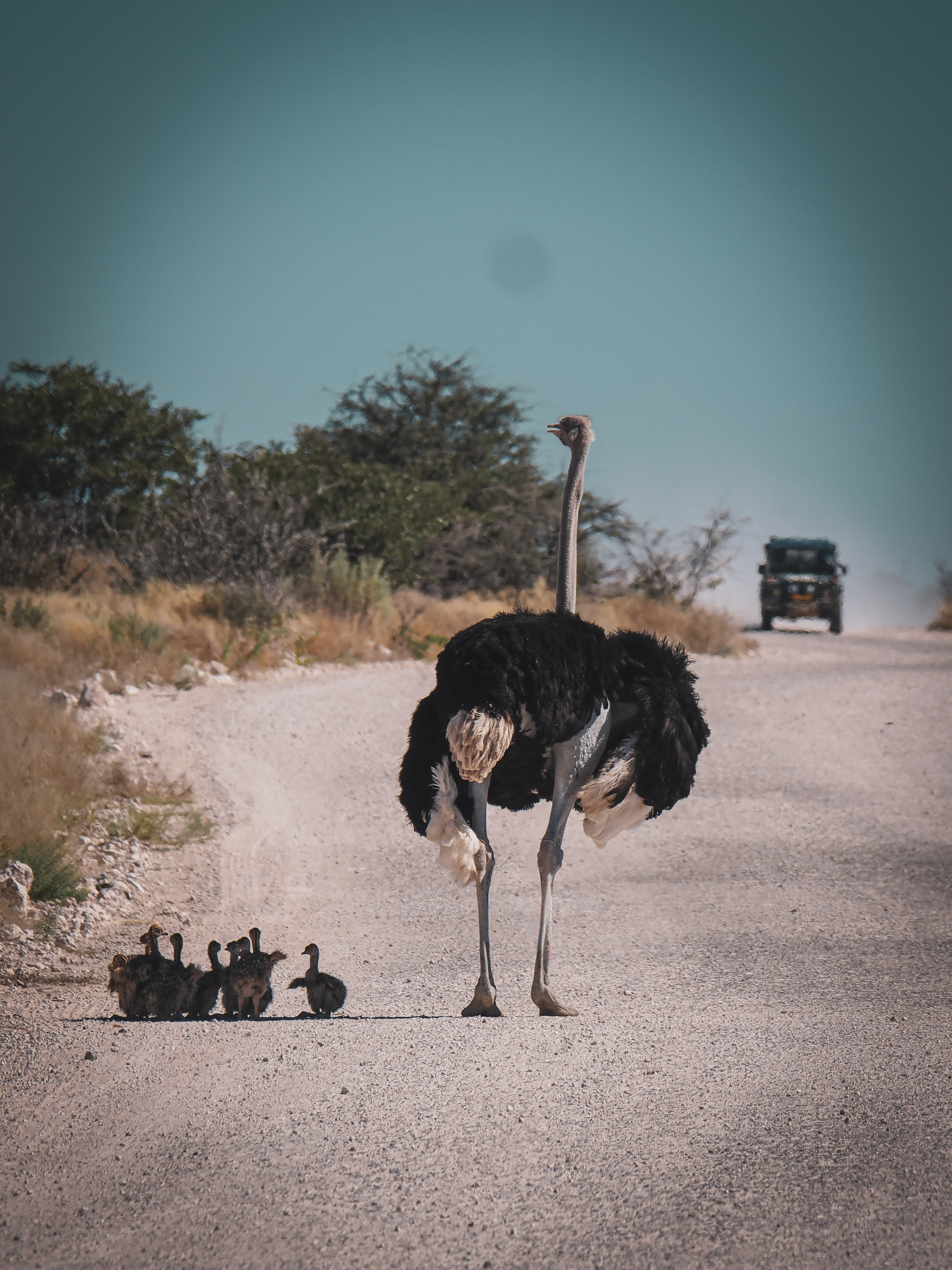
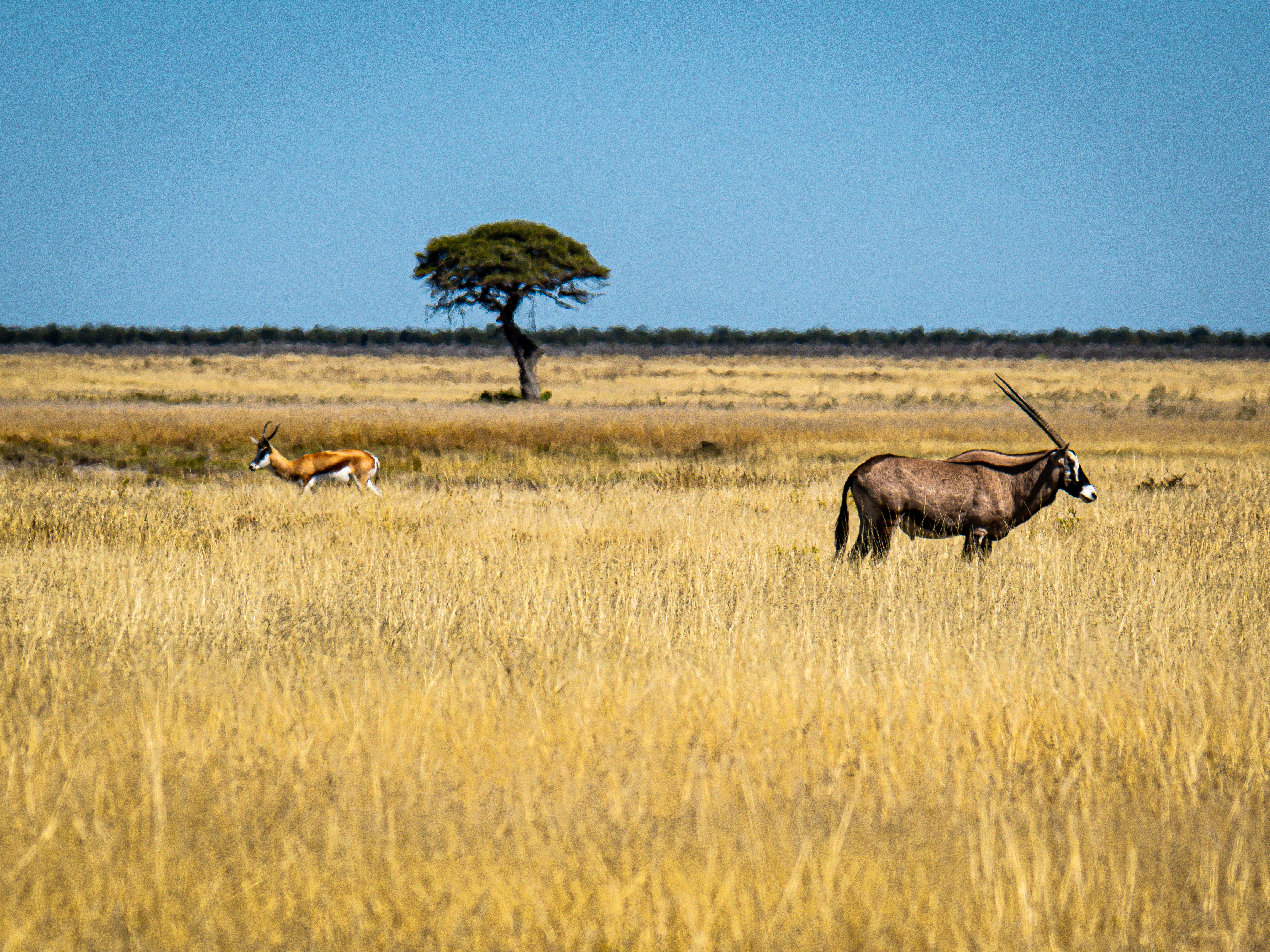
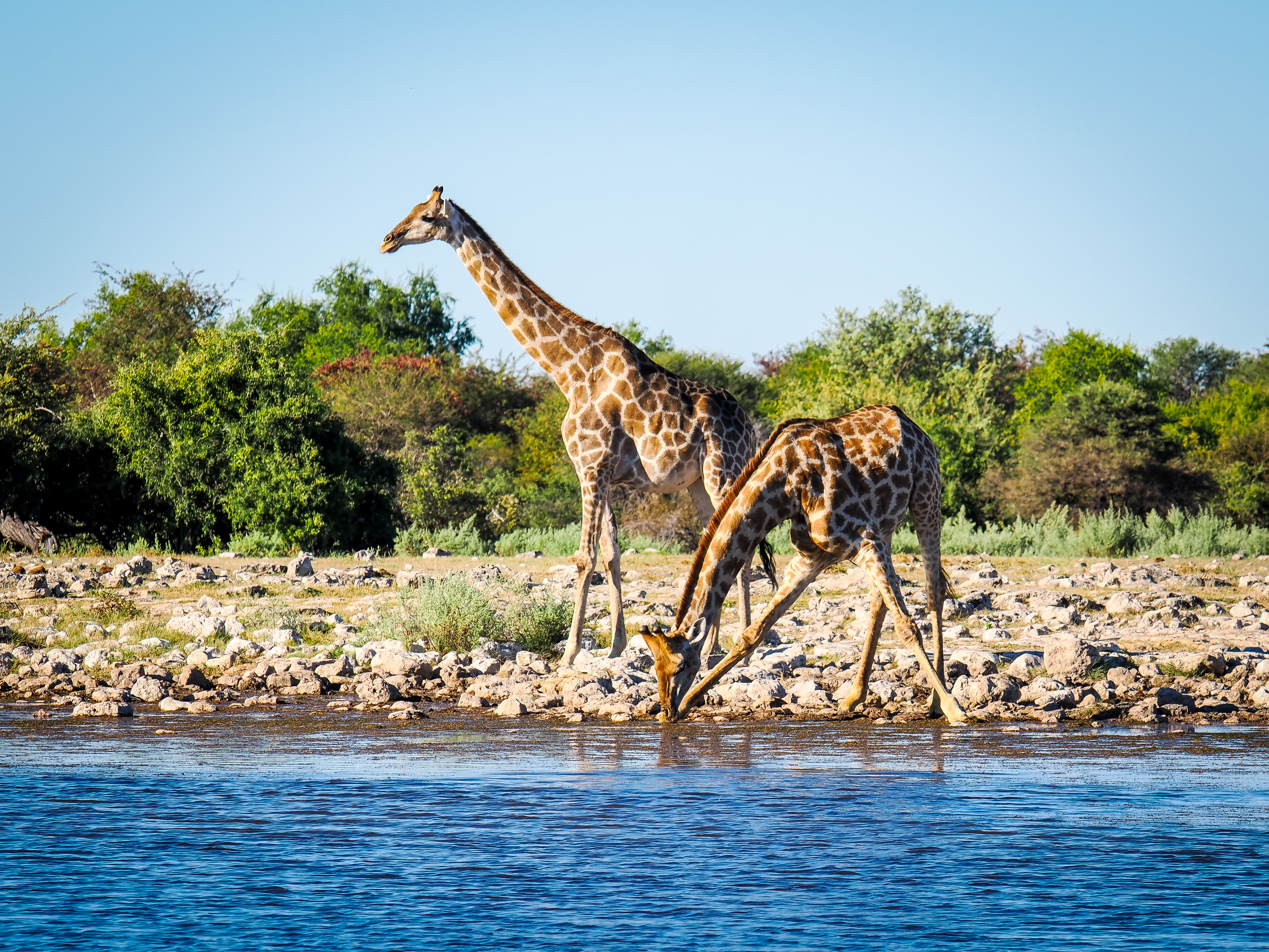
The wildlife list is genuinely big: elephant, lion, leopard, cheetah, giraffe, zebra, springbok, oryx (gemsbok), kudu, eland, red hartebeest, the localised black-faced impala, and the endangered black rhino, which Etosha protects in one of the most important populations on earth. It is one of the very best places in the world to see black rhino, most often after dark. (As a conservation precaution, we don’t publish specific rhino sighting locations anywhere in this guide.) The park is home to four of the Big Five (no buffalo) and around 114 mammal species and over 340 birds.
But the single thing to understand before you go is how you watch wildlife here, because it is different from almost anywhere else.
The big idea: Etosha is a waiting game
Most famous safari parks are built on rivers. The Serengeti, Kruger, the Okavango — animals are spread across green country and you drive to find them. Etosha has no permanent rivers at all. For much of the year, the waterholes are the only reliable water in the entire ecosystem, and that changes everything.
It means the wildlife comes to you. In the dry season, every elephant, every zebra, every lion in a given area must eventually walk to a waterhole to drink. So instead of chasing sightings, you pick a productive waterhole, switch off the engine, and wait. Twenty quiet minutes at the right hole will out-perform an hour of driving. A herd of sixty elephant filing in to drink, a black rhino materialising out of the dusk, lions flopping in the shade by the water — Etosha rewards stillness more than mileage.
Some waterholes are natural springs (fed by underground water or seasonal rain — more atmospheric, but they can dry up or go quiet unpredictably). Others are artificial boreholes pumped by the park authority to hold water year-round. From the animals’ point of view they serve the same purpose; from yours, the pumped holes are the more reliable bet in peak dry months, while the natural ones reward patience and luck. We’ll flag which is which in the waterhole section.
Getting there and the four gates
Opening hours & getting in
Etosha has four entry gates, and which one you use shapes your whole trip. All gates open at sunrise and close at sunset (roughly 06:00–07:30 open, 17:30–19:30 close, shifting with the season), and you must present an in-park accommodation booking or pay day-entry at the gate.
The four gates
Anderson Gate (south) — also spelled Andersson — is the main access point and the closest to Windhoek (about 430 km / 5 hours via Otjiwarongo and Outjo). It leads straight to Okaukuejo, 17 km inside on tar. Most first-timers come in this way. Last fuel: Outjo, ~108 km before the gate.
Von Lindequist Gate (east), also called Namutoni Gate, is reached via Tsumeb and opens onto Namutoni, 10 km in. It’s the natural choice if you’re looping down from the Caprivi or starting an east-to-west circuit. Last fuel: Tsumeb, ~75 km before the gate.
King Nehale lyaMpingana Gate (north) is the least-used gate, on the northern boundary near Ondangwa/Oshakati. It opens onto the remote northern section (Andoni plains) and is handy only if you’re coming from far northern Namibia.
Galton Gate (west) serves only the far-western section and Dolomite Camp. Here’s the important part for self-drivers: Galton is not connected to the main park road network in the way the others are, and current access is essentially for Dolomite Camp guests, with game viewing in the west done as guided drives. You cannot simply enter at Galton and free-range self-drive across the west to Okaukuejo. The rules around western access have changed more than once over the years, so confirm the current Galton/Dolomite self-drive policy with NWR when you book.
A common and rewarding route for everyone else is to enter at Anderson in the south and exit at Von Lindequist in the east (or the reverse), driving the length of the park’s southern edge over two to four days and overnighting at the rest camps along the way.
🚪 GATE PICKER — which gate for you
| Your situation | Use this gate |
|---|---|
| First visit, coming from Windhoek | Anderson (south) |
| Coming from Tsumeb / Grootfontein / Caprivi | Von Lindequist (east) |
| Doing a one-way loop | Anderson in → Von Lindequist out (west-to-east) |
| Booked at Dolomite Camp | Galton (west) |
| Arriving from far northern Namibia | King Nehale (north) |
Park fees and the rules that matter
What it costs
As of the rates effective 1 April 2026, daily conservation/entry fees are around NAD 280 per foreign (non-SADC) adult per day (split as ~NAD 140 entrance + NAD 140 conservation), plus roughly NAD 60 per vehicle per day for a standard car (up to 10 seats). SADC-region adults pay less, Namibian residents least; children under 8 are typically free and 8-to-under-16 are reduced. Fees are paid at the gate or your rest-camp reception by cash or card — keep the receipt for your whole stay and your permit on the dashboard. (Park fees change yearly — verify current figures on the MEFT/NWR schedule before you travel.)
The two iron rules
Two rules govern everything in Etosha, and both are non-negotiable:
You must be inside a rest camp, or out of the park, by sunset. Driving after dark inside Etosha is prohibited, and the camp booms and gates close on time. Plan every afternoon drive around getting “home” before the light goes — and don’t cut it fine, because a single elephant on the road can cost you twenty minutes.
You may not get out of your vehicle except at designated, fenced points (camps, and a handful of marked picnic/toilet stops). The animals are wild and lions are common. Stay in the car, switch off the engine, and let the bush settle around you.
Every rest camp inside the park
Etosha’s accommodation falls into two groups: the six NWR (Namibia Wildlife Resorts) camps inside the park — the backbone of any self-drive trip — and a ring of private lodges and reserves just outside the boundary. Book the in-park camps as far ahead as you can; the floodlit-waterhole chalets and the campsites sell out months in advance for peak season.
Okaukuejo — the floodlit icon

Okaukuejo (say it “oh-kah-KOO-yo”) is the park’s headquarters in the south, 17 km from Anderson Gate, and the most famous of all the camps thanks to its floodlit waterhole. This is the one people travel for: a low stone wall, tiered benches, and a waterhole lit through the night where elephant, lion and a steady parade of game come to drink, sometimes all at once — and, on a lucky night, the shy nocturnal visitors that make Etosha’s floodlit waterholes famous. Sit there after dinner and you may not move for hours. The camp is built around a landmark stone observation tower, and offers everything from waterfront chalets to a busy campsite, a restaurant, shop, pool and fuel. It’s the busiest, most institutional camp — but that waterhole earns its fame.
Halali — the quiet middle
Halali sits roughly midway along the southern edge of the pan, between Okaukuejo and Namutoni — the only camp truly in the central park. It’s smaller and calmer than Okaukuejo, with the largest pool of the camps (a blessing at midday) and its own excellent floodlit waterhole, Moringa, reached on a short walk up through the camp. Moringa is widely rated the best floodlit hole for leopard in a more intimate, less crowded setting than Okaukuejo. Halali is also superbly placed for the cluster of productive central waterholes (Goas, Rietfontein, Salvadora, Sueda). Chalets, campsites, restaurant, shop and fuel.
Namutoni — the German fort

Namutoni, in the east near Von Lindequist Gate, is the most characterful camp: built around a gleaming white former German colonial fort dating to the early 1900s, overlooking the King Nehale waterhole. Sundowners on the fort walls are a Namutoni tradition. It’s the gateway to the eastern grasslands, the lovely Fischer’s Pan loop and the Dik-Dik Drive, where the tiny Damara dik-dik is reliably seen. Its own floodlit waterhole is less consistent than Okaukuejo’s but still rewarding. Chalets, campsite, two restaurants, shop, pool and fuel.
Dolomite — the wild west
Opened in 2011, Dolomite Camp unlocked the far-western section that was off-limits to ordinary visitors for decades. It’s a stylish, unfenced camp of thatched chalets strung along a dolomite ridge, with arguably the best sunset and sunrise views in Etosha and a genuinely remote feel. The western section it serves is quieter and wilder, with special species like Hartmann’s mountain zebra and black-faced impala. Access is via Galton Gate, and western game viewing is generally done on guided drives from the camp rather than free self-drive — confirm specifics when booking.
Onkoshi — the eco-camp on the pan
Onkoshi is NWR’s intimate, eco-conscious flagship: a low-impact camp of just over a dozen raised, tented chalets on stilts right on the edge of the Etosha Pan, north-east of Namutoni. The pan views — especially at sunrise and in the green season when water spreads across the shallows — are extraordinary, and it’s the most exclusive of the in-park options. It cannot be self-driven to: guests park at Namutoni and are transferred in by NWR vehicle, which keeps the area pristine. Bring everything you need; this is a switch-off-completely sort of place.
Olifantsrus — the camping-only hide camp
Olifantsrus, in the west between Dolomite and Okaukuejo, is the park’s newest and most unusual camp: camping only (no chalets), with smart ablutions and a small kitchen, on the site of a former elephant-culling station whose history it now interprets. Its showpiece is a superb double-storey waterhole hide — you can sit at eye level with drinking elephants, often in near-total quiet, and even watch through the night from the upper deck. For photographers and campers willing to be self-sufficient, it’s a hidden gem. No fuel or shop to speak of — arrive stocked.
🏕️ CAMP COMPARISON — the six in-park camps
| Camp | Where | Floodlit waterhole | Self-drive? | Best for |
|---|---|---|---|---|
| Okaukuejo | South (Anderson Gate) | Yes — famous floodlit hole | Yes | First-timers; floodlit night viewing |
| Halali | Central | Yes — Moringa (leopard) | Yes | Central waterholes; calm; pool |
| Namutoni | East (Von Lindequist) | Yes — less reliable | Yes | Fort character; eastern loops; dik-dik |
| Dolomite | Far west (Galton) | No | Guided drives | Remote feel; wilderness; views |
| Onkoshi | NE pan edge | No | No — transfer from Namutoni | Exclusivity; pan views; green season |
| Olifantsrus | West | Day/night hide | Yes (camping only) | Photographers; campers; the hide |
The private reserves around the park
If your budget stretches, the ring of private reserves bordering Etosha offers things the national park cannot: off-road driving, night drives, guided walks, and far fewer vehicles — plus, on some, their own big game and predators. Many travellers pair a few self-drive nights inside the park with a night or two outside for the guided experience.
On the southern boundary, the 30,000-hectare Ongava Private Game Reserve is the standout, with a family of lodges (Ongava Lodge, Little Ongava, Ongava Tented Camp and Andersson’s at Ongava, the latter with a clever underground photographic hide) and superb guided game viewing. The vast Etosha Heights reserve (Safarihoek and Mountain lodges) and budget-friendly options like Toshari Lodge and the Gondwana Etosha Safari Camp/Lodge also sit south of Anderson Gate.
On the eastern boundary, near Von Lindequist Gate, the Onguma collection spreads across 34,000 hectares with everything from the five-star Fort to tented camps and campsites; Mokuti Etosha Lodge sits just 8 km from the gate with easy park access; and the Mushara collection (Lodge, Bush Camp, Outpost and Villa) offers polished small-lodge stays a short drive out.
The trade-off is simple: inside the park you get the legendary waterholes and self-drive freedom at low cost; outside, you pay more for guiding, exclusivity and activities the park bans. The best trips often use both.
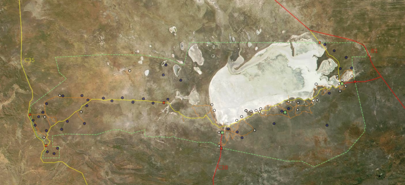
The waterholes — the heart of Etosha
This is the section to read twice. In Etosha, choosing the right waterhole at the right time of day is the entire game. There are dozens scattered along the southern arc of the pan and through the east and west; below is how to think about them — by region, by floodlight, by camp, by animal — followed by a master reference table.
The floodlit waterholes: night viewing without a night drive
Three camps have floodlit waterholes you can watch all night from within the fence — a rare, passive, magical kind of game viewing found almost nowhere else.
Okaukuejo is the headline act: elephant, lion, hyena, jackal and the occasional leopard, often at close range — with the chance of rarer nocturnal visitors. Halali’s Moringa is quieter and more intimate, especially good for leopard. Namutoni’s is the least predictable but can still deliver in the dry months. The technique is the same at all three: arrive before dark, settle in, keep noise and movement to a minimum, dress warm in winter, and be patient — long quiet spells are normal before sudden drama.
🦏 INFO BOX — How to watch a floodlit waterhole
- Claim your spot before sunset. The best benches at Okaukuejo fill up fast.
- Go quiet and stay quiet. No flash photography, no torches, low voices — animals are skittish in the light.
- Give it time. The shyest, rarest visitors often come late (9 pm–midnight). The patient win.
- Layer up. Winter nights (Jun–Aug) drop near freezing.
- Keep a log. Note what came and when — it helps you plan the next night and the day’s drives.
Best waterholes by region
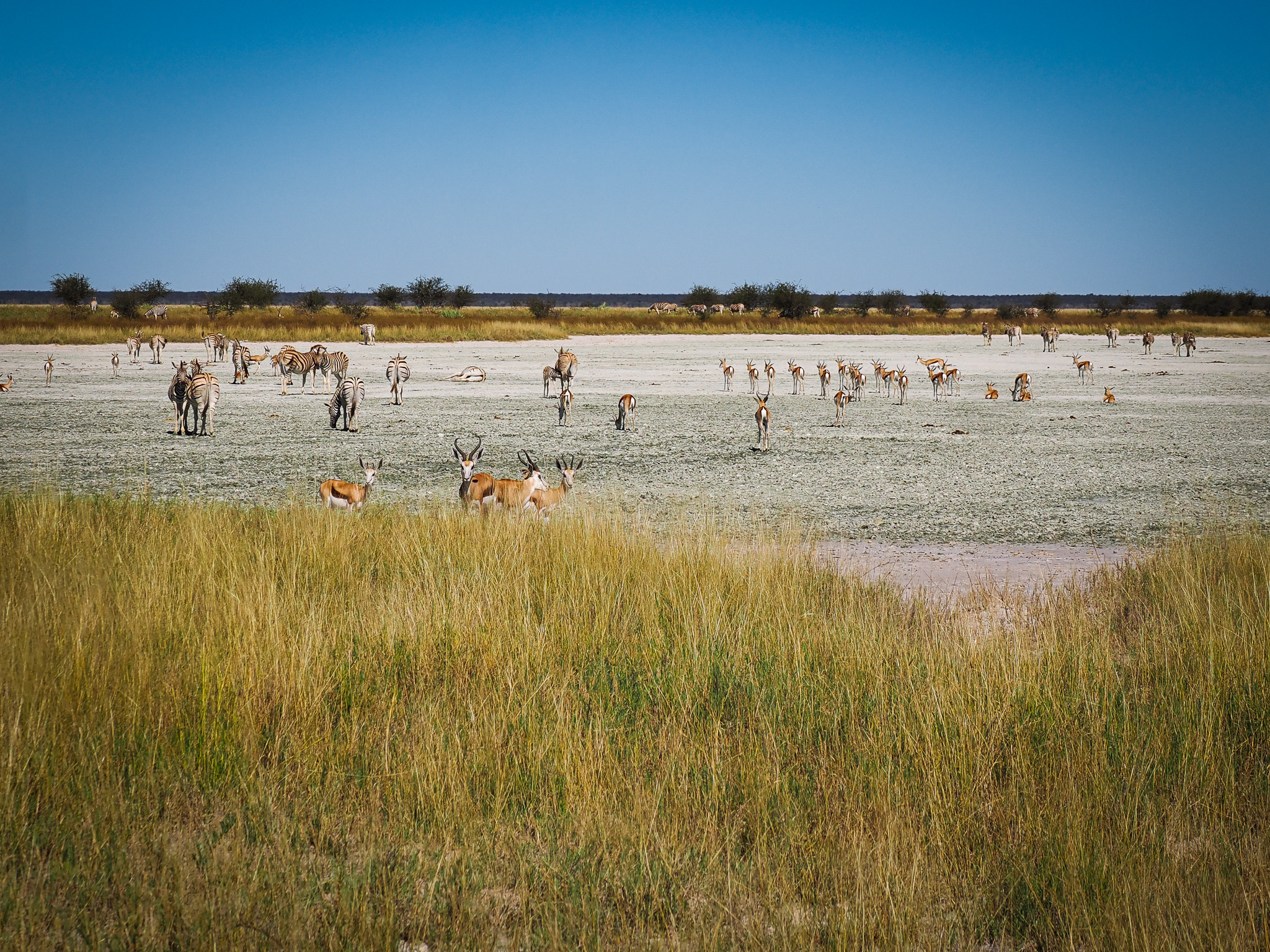
Central Etosha (around Okaukuejo) is the park’s most reliable wildlife zone — open short-grass plains, constant water and high density. Star holes: Okaukuejo itself (famous floodlit night viewing), Okondeka on the western pan edge (your best bet for lion with plains-game herds — zebra, springbok, wildebeest, ostrich), and Nebrownii (elephant herds and strong predator presence, right by the camp). Add Gemsbokvlakte, Olifantsbad and Ombika for elephant, lion and a broad antelope cast.
Eastern Etosha (around Namutoni) is flatter and more open, with wide pans and superb visibility — at its best in the late dry season and after rain, when plains game gathers along the pan edges. Stars: Chudop (reliable elephant and mixed plains game), Klein Namutoni (an artesian spring drawing black-faced impala, giraffe, leopard, hyena at dusk), Two Palms on Fischer’s Pan (beautiful sunsets), Fischer’s Pan itself (huge herds and waterbirds after rain), and Okerfontein.
Western Etosha (around Dolomite/Galton) is the quiet, wild quarter — a true wilderness feel with far fewer vehicles. Stars: Dolomietpunt (mountain zebra, giraffe, elephant) and Charitsaub with good predator activity. (Mostly experienced via guided drives from Dolomite.)
Best waterholes by what you want to see
🐾 QUICK PICKS — by animal
| You want… | Go to… |
|---|---|
| Black rhino | After dark at the floodlit waterholes — exact spots kept private (conservation) |
| Lion | Okondeka, Salvadora, Klein Namutoni |
| Leopard | Moringa (Halali), Goas, Ngobib |
| Cheetah | Salvadora, Okerfontein, the open central flats |
| Elephant herds | Okaukuejo, Nebrownii, Chudop, Olifantsrus hide |
| Giraffe & plains game | Fischer’s Pan, Gemsbokvlakte, Sueda |
| Birds / flamingos (green season) | Fischer’s Pan, Rietfontein, the pan edge |
| Photographers’ favourite | Kalkheuwel (close approach, lovely light) |
The waterhole master list
A working reference to the named holes you’ll see signposted, roughly west-to-east, with their type and what they’re known for. Use it with the map above and the camp sightings books, which guests update daily.
| Waterhole | Sector / nearest camp | Type | Known for |
|---|---|---|---|
| Okondeka | Central / Okaukuejo (W pan edge) | Spring | Lion, big plains-game herds |
| Okaukuejo | Central / Okaukuejo | Borehole (floodlit) | Elephant, lion, after-dark game |
| Nebrownii | Central / Okaukuejo | Borehole | Elephant herds, predators |
| Ombika | Central / Okaukuejo | Spring | Lion, general game (near Anderson Gate) |
| Gemsbokvlakte | Central / Okaukuejo | Borehole | Elephant, lion, antelope variety |
| Olifantsbad | Central / Okaukuejo | Borehole | “Elephant bath” — elephant, lion, antelope |
| Aus | Central / Okaukuejo | Borehole | Quiet; antelope, occasional predators |
| Ozonjuitji m’Bari | South-central (remote) | Borehole | Roan antelope, big herds (long drive) |
| Salvadora | Central / Halali (pan edge) | Spring | Lion & cheetah on the open flats |
| Sueda | Central / Halali (pan edge) | Spring | Plains game, predators (pairs with Salvadora) |
| Charitsaub | Central / Halali (pan edge) | Spring | Predators, classic pan-edge views |
| Rietfontein | Central / Halali | Spring | One of the best all-rounders; birds, lion, elephant, leopard |
| Goas | Central / Halali | Spring | Leopard, elephant, black-faced impala, birding |
| Moringa | Halali camp | Borehole (floodlit) | Intimate floodlit night viewing; leopard |
| Homob | Central / Halali (pan edge) | Spring | Lion, elephant near the pan |
| Nuamses | Central / Halali | Spring | Small, atmospheric — best afternoons |
| Kalkheuwel | Central-east / Halali–Namutoni | Borehole | Photographers’ favourite; close game, raptors |
| Chudop | East / Namutoni | Spring | Reliable elephant & mixed plains game |
| Klein Namutoni | East / Namutoni | Artesian spring | Black-faced impala, giraffe, leopard, hyena |
| Klein/Great Okevi | East / Namutoni | Spring | Kudu, zebra, elephant; cheetah/leopard nearby |
| King Nehale | Namutoni camp | Borehole (floodlit) | Giraffe, elephant; quelea roosts at dusk |
| Two Palms (Twee Palms) | East / Namutoni (Fischer’s Pan) | Spring | Iconic makalani palms, sunsets |
| Fischer’s Pan | East / Namutoni | Seasonal pan | Huge herds & waterbirds after rain |
| Okerfontein | East / Namutoni | Spring | Cheetah, lion on the pan edge |
| Andoni Plains | North / King Nehale | Seasonal | Open grassland; rare birds, plains game |
| Renostervlei | West / Dolomite | Spring | Quiet western spring; wilderness game |
| Dolomietpunt | West / Dolomite | Spring | Mountain zebra, giraffe, elephant |
Note: water levels and activity shift seasonally; natural springs can run quiet or dry late in the dry season, while pumped boreholes stay reliable. Always cross-check the camp sightings book the night before.
The routes and circuits
Etosha’s road network is essentially one main gravel artery running west-to-east along the southern edge of the pan (the old C38 backbone), linking the three classic camps, with a web of loops and spurs peeling off to individual waterholes. The roads are well-graded gravel — fine for a 2WD most of the year — and the speed limit is 60 km/h, but you’ll see far more dawdling at 30–40 km/h. Crucially, distances feel short on paper but eat the day: allow two to three hours camp-to-camp once you factor in stops.
The southern artery (Okaukuejo → Halali → Namutoni). This is the spine of a self-drive trip. Okaukuejo to Halali is about 70 km (allow ~1¾ hrs with stops); Halali to Namutoni another 75 km or so (another ~1½–2 hrs). Along the way you peel off to the central pan-edge holes (Salvadora, Sueda, Charitsaub, Rietfontein, Goas).
The Okaukuejo loops (west-central). Short circuits south and west of Okaukuejo string together Ombika, Gemsbokvlakte, Olifantsbad, Aus and the lion-favoured Okondeka on the pan edge — an easy, productive morning without committing to a camp move.
The Halali cluster (central). Arguably the richest concentration of waterholes in the park sits within an hour of Halali — perfect for “base here and radiate out” days. Don’t miss Rietfontein and Goas.
The eastern loops (Namutoni). The Fischer’s Pan loop and the Dik-Dik Drive are the highlights — Two Palms for sunset, the seasonal pan for herds and birds, and the mopane thickets for Damara dik-dik. The far north-east runs out toward the Andoni plains and King Nehale.
The western section (Dolomite). A different world — remote, hilly dolomite country reached via Galton Gate, generally explored on guided drives from Dolomite Camp rather than free self-drive. Best for a true wilderness feel and quiet, low-traffic game viewing.
📏 DISTANCES & DRIVE TIMES (with game-viewing stops)
| Leg | Distance | Realistic time |
|---|---|---|
| Windhoek → Anderson Gate | ~430 km | ~5 hrs |
| Anderson Gate → Okaukuejo | 17 km (tar) | 20 min |
| Okaukuejo → Halali | ~70 km | 1¾–2½ hrs |
| Halali → Namutoni | ~75 km | 1½–2½ hrs |
| Namutoni → Von Lindequist Gate | 10 km | 15 min |
| Dolomite → Okaukuejo (west transit) | ~180 km | ~4 hrs |
Golden rule: never plan to arrive at camp “just before” the gate closes. Build in a buffer for the elephant standing in the road.
How to actually drive Etosha
The technique here is the opposite of a river park. Let the animals come to the water.
Pick a waterhole and wait. Twenty minutes of stillness at a productive hole beats an hour of cruising. Switch the engine off, open the windows, and listen.
Drive the golden hours. Be at the gate the moment it opens, and stay out until the last safe minute before sunset. Midday is hot, bright and quiet — the time to retreat to camp, swim, and let the harsh light pass.
Go slow and scan. 30–40 km/h lets you catch the lion flat under a bush, the rhino on the tree line, the cheetah on a termite mound. Scan the pan edge and the shade.
Work the sightings book. Every camp keeps a guest sightings log — where leopard, rhino and cats were seen, and when. Read it each evening and plan tomorrow’s holes around it.
Carry the essentials in reach. Binoculars for every passenger, water, snacks, a charged camera, and a printed map (signal is patchy). And never, ever step out of the vehicle away from a marked point.
When to go — the seasons in depth
Timing is the single biggest factor in what you’ll see, because it dictates whether animals are concentrated at the waterholes or scattered across green bush. Etosha has two broad seasons, each with sub-phases worth understanding.
Dry season (May–October): the classic waterhole safari
This is what most people picture, and the easiest, most reliable game viewing of the year. As the land dries, surface water vanishes and wildlife is forced to concentrate at the permanent waterholes in growing numbers. Sightings are predictable and prolonged; the thin, leafless bush makes animals easy to see; skies are clear and mosquitoes few.
- May–June — early dry. The bush is still drying out and a little green lingers, days are pleasant and nights cooling. Good viewing, fewer crowds, lower prices. A lovely, underrated window.
- July–August — high-season dry. Cold mornings (pack serious layers — near freezing at dawn), warm days, building concentrations at the holes. Excellent and busy.
- September–October — the peak. Bone dry, brutally hot by October, and the waterholes are at their most spectacular: huge elephant herds, predators on the prowl, near-constant action at the pumped holes. The best wildlife viewing of the year — and the busiest and priciest. Book far ahead.
Green season (November–April): the photographer’s secret
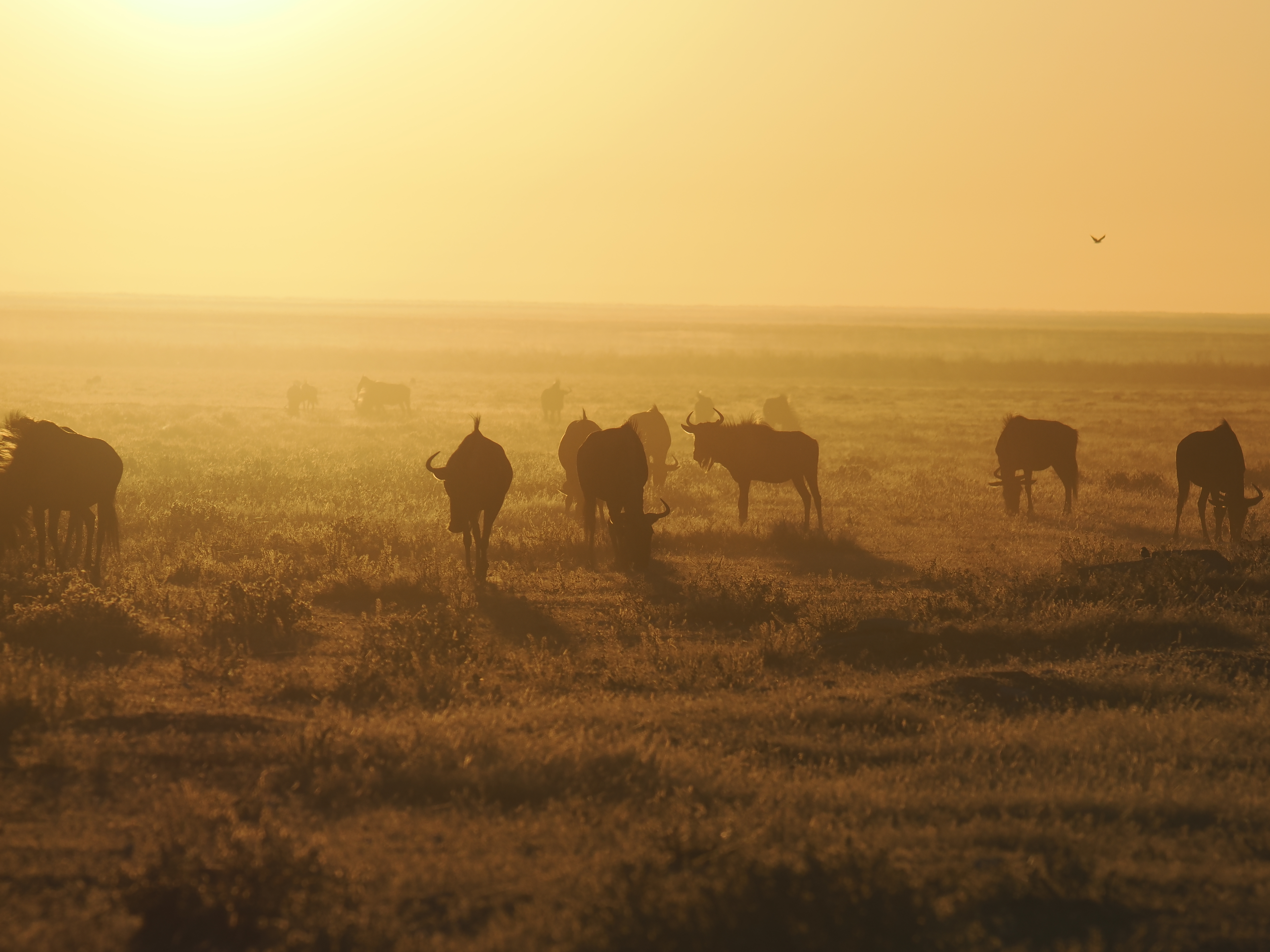
.jpg?width=1280)
The rains transform Etosha. Water spreads across the bush and the seasonal pans, so animals disperse away from the waterholes and big concentrated sightings get harder. But the trade-offs are wonderful: the landscape turns lush and dramatic, the light is superb after storms, calving season fills the plains with newborn springbok, zebra and wildebeest (and the predators that follow them), migrant birds arrive in their millions, and if the pan floods, flamingos gather in their thousands on the shallows. Prices drop and vehicles thin out.
- November–December — early rains, the “green flush” begins; first newborns; building birdlife; still some waterhole activity. A fine shoulder.
- January–March — full green season; calving peak; spectacular birding and skies; lowest prices; hardest for big-cat-at-water sightings. Namibia’s desert circuit (Sossusvlei, the coast) pairs beautifully here.
- April — the rains ease; the bush is at its most beautiful and green before drying begins. A quiet, photogenic, value window.
📅 SEASON MATRIX — at a glance
| Factor | Dry (May–Oct) | Green (Nov–Apr) |
|---|---|---|
| Wildlife at waterholes | Concentrated, easy, predictable | Dispersed, harder |
| Best for | Big game, predators, rhino, classic safari | Birding, newborns, flamingos, photography |
| Landscape | Brown, dusty, thin bush | Lush green, dramatic skies |
| Crowds & price | Higher (peak Sep–Oct) | Lower |
| Weather | Warm days, cold dawns (Jul–Aug); very hot (Oct) | Hot, humid, afternoon storms |
| Roads | Easy gravel | Mostly fine; some pan edges soft after rain |
So when should you go? For your first Etosha and the iconic waterhole spectacle, aim for August–October. For green landscapes, baby animals, flamingos and a quieter, cheaper park — and you don’t mind working harder for sightings — December–April is genuinely wonderful and underrated. May–June is the sweet-spot compromise: good game, cooler air, fewer people.
Suggested self-drive itineraries
The classic 3-night south-to-east loop. Enter at Anderson Gate in the morning, drive slowly to Okaukuejo and spend your first afternoon and evening at its floodlit waterhole. Day two, work the central holes east toward Halali, overnight there for a second floodlit session at Moringa. Day three, continue east through the grasslands and Fischer’s Pan to Namutoni, then exit at Von Lindequist the next morning. Two nights is possible but rushed; this three-night version is the comfortable minimum.
The relaxed 4–5 night version. As above, but give Okaukuejo and Namutoni two nights each, using full days to radiate out to the waterhole clusters rather than racing camp-to-camp. This is how Etosha is best enjoyed — slowly. Add the Olifantsrus hide as a day stop or camping night for something different.
The wilderness add-on (west). If budget and time allow, bookend the trip with one or two nights at Dolomite (via Galton Gate) for the remote western section and a wilder feel, or splurge a night at Onkoshi on the pan edge. These pair the park’s legendary waterholes with a wilder, more exclusive Etosha.
Pairing Etosha into a bigger Namibia trip. Most travellers slot Etosha into a wider self-drive loop. It sits naturally after the Waterberg or before/after the far north, and combines superbly with the desert and coast — see our Living Desert Tour, Swakopmund and the broader 4×4 hire & self-drive guide.
Practical checklist
Fill your fuel tank before entering (Outjo or Tsumeb) and top up at the camps when you can, but never depend on in-park fuel being available. Carry plenty of drinking water, snacks and a cooler — you’ll be in the car for long stretches between facilities. Bring binoculars for every passenger; at a waterhole they make all the difference. Pack warm layers for winter mornings (genuinely cold) and strong sun protection for the rest of the day. Carry a printed or offline map — phone signal is patchy to non-existent. Keep cash (Namibian dollars / South African rand) and a card for fees. And keep a notebook for the sightings book: half the fun of Etosha is comparing notes with the camp each evening.
✉️ PLANNING AN ETOSHA SELF-DRIVE?
We’ve driven these roads ourselves and are happy to share what we learned — which camps to prioritise, how to sequence the gates, and which waterholes were paying off when. If you’d like a hand shaping your Namibia route, drop us a note via our contact form and we’ll gladly point you in the right direction.

Leave a comment